Ft Reno, Wyoming

Locked
Pat Holscher
Society Member
Posts: 7553
Joined: Thu Nov 30, 2000 6:51 pm
Last Name: Holscher

Recently I posted a thread of photographs about Ft. Phil Kearney ( viewtopic.php?f=3&t=11373 ). This one is in the same spirit, but deals instead with the lesser known Ft. Reno.

Image

Ft. Reno was the earliest of the Powder River Basin and the southernmost fort to be dedicated to the "Bloody" Bozeman Trail. It was was the next fort south from Ft. Phil Kearney, which didn't make it close by any means. It was probably something like a good 30 to 40 mile ride on the Bozeman from the post to Ft. Phil Kearney, making it basically unable to render, or receive, any effective assistance from that post. It was equally isolated to the south, with Platte Bridge Station, an Oregon Trail station, being the next Army installation to the south. Platte Bridge Station was probably something like 60 miles or more as the crow flies.

In other words, Ft. Reno was out there by itself.

Unlike Ft. Phil Kearney the post wasn't constructed as part of an immediate post Civil War effort to protect the Bozeman Trail. Ft. Reno was actually the first post built in the Powder River Basic, and it would be the last abandoned. It was originally constructed in 1865 by the 6th Michigan Cavalry, commanded by Patrick Connor, for his 1865 Powder River Expedition. It was a cantonment, that is a supply depot, built for that purpose. It was almost immediately renamed Ft. Reno, and the Michigan cavalry rode off almost as soon as they built it, leaving it for the 5th U. S. Volunteers (Galvanized Yankees) and 70 mounted scouts of Company A, Omaha Scouts. So, in its early days, it was occupied by dispossessed Confederates and native scouts.

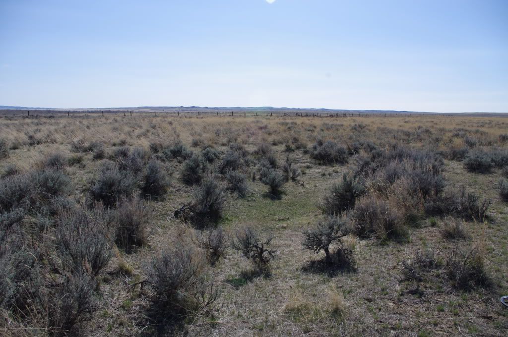
In 1866 Carrington's command of regulars relieved the Civil War 5th U.S. Vol and rebuilt the fort. It was added on to in 1867. Like Ft. Phil Kearney, it had a stockade. Stockade construction would have had to rely on cottonwoods, which would have made it quite the project. The post was abandoned in 1868 as a result of Red Could's War, and they burned it down. Not much is left today, and it's very much out of the way, as these photographs will demonstrate.

Image
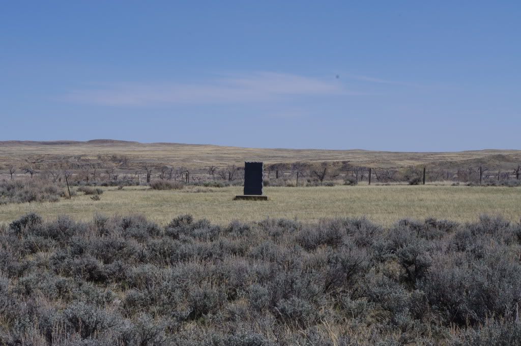
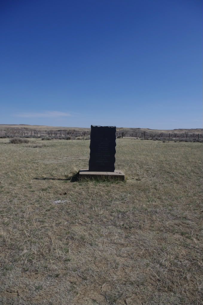
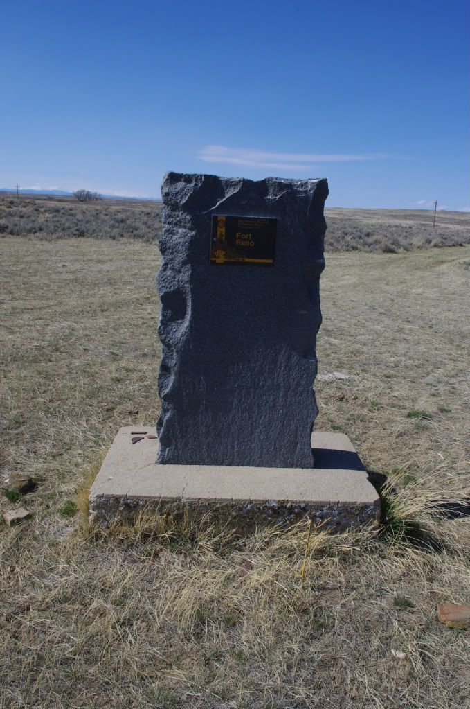
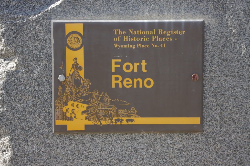
State of Wyoming marker showing the fort's evolution.

Image
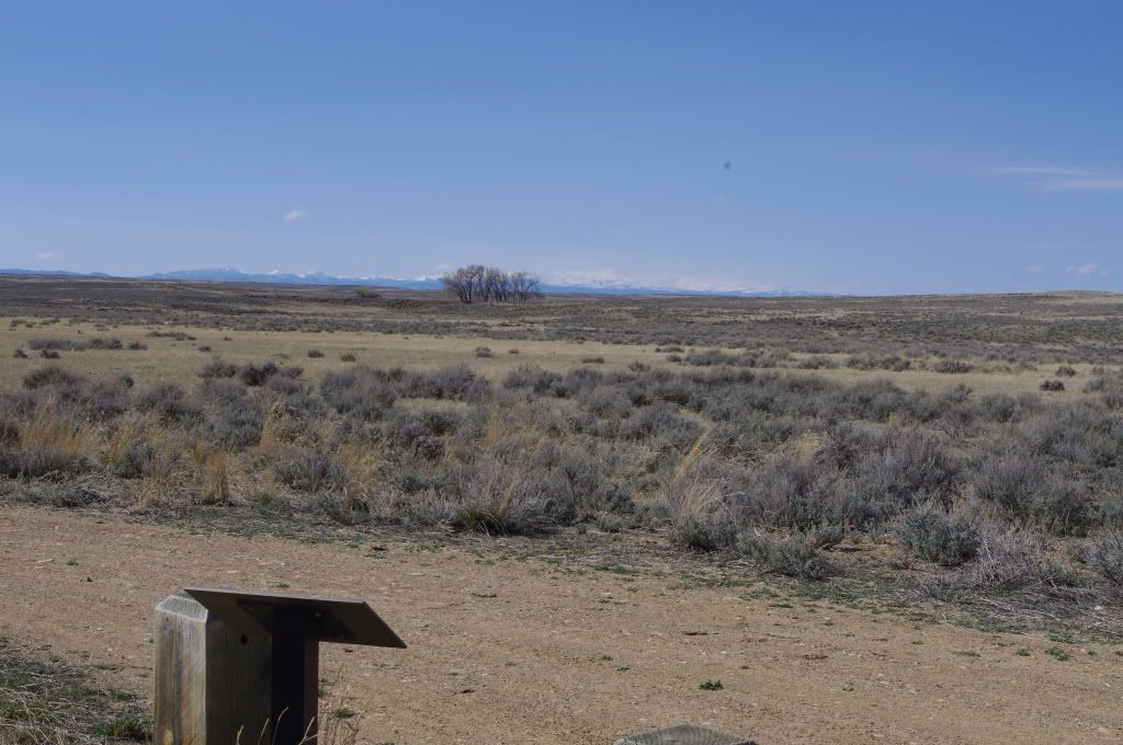
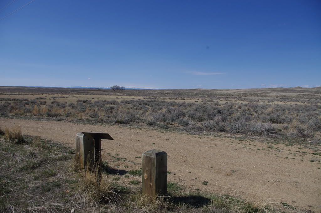
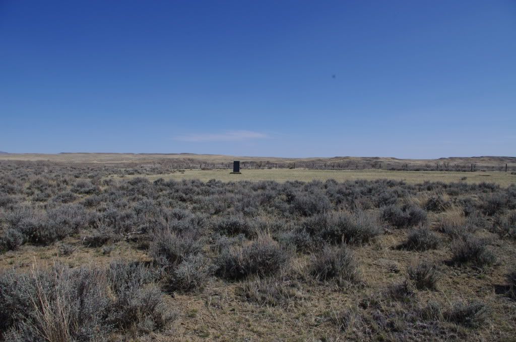
The sign above, looking out on where the post had been.

Image

Image
State of Wyoming depiction of what the fort had looked like, based on period depictions.

Image

Image

Image
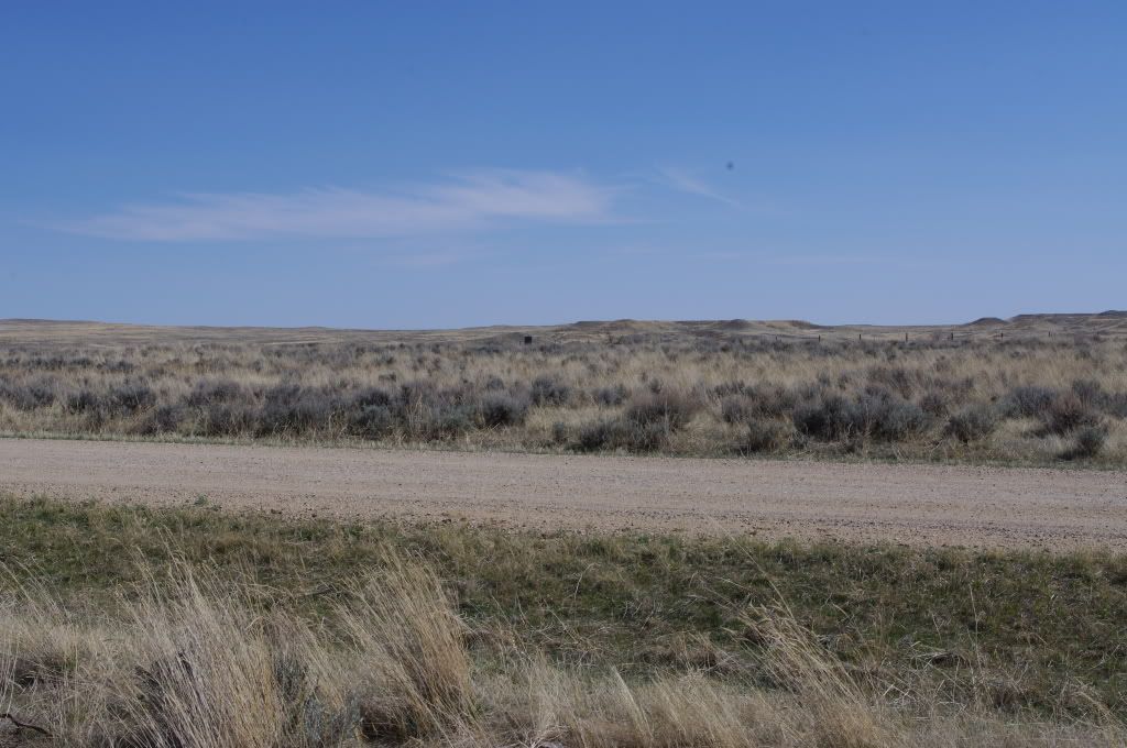
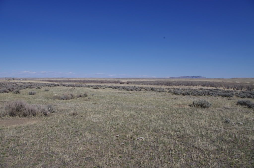
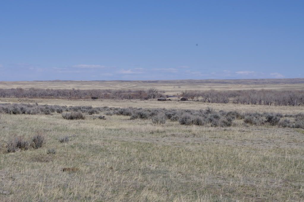
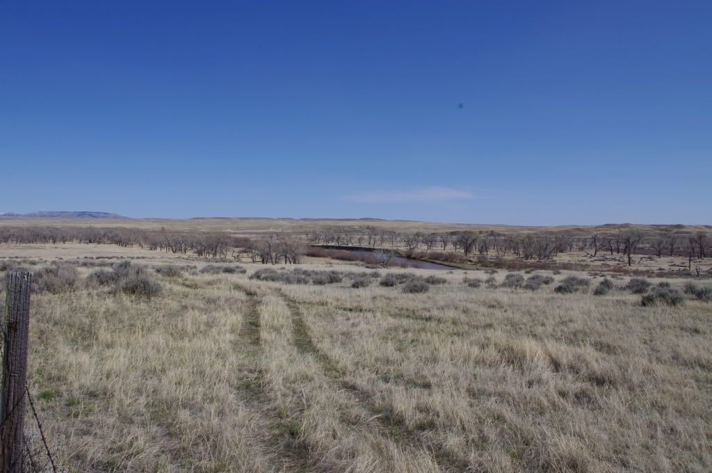
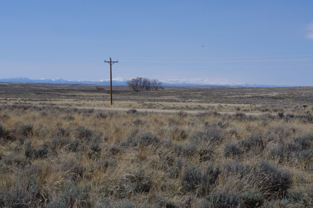
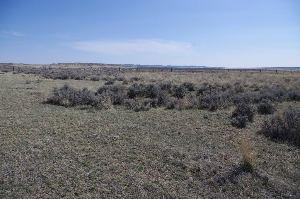
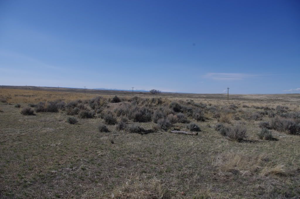
Looking out towards where the fort once was. The Powder River (which will be in an upcoming photograph) is between the foreground and the horizon, but is not visible in these photographs. In the last two photographs, you can actually see the foundation of a building, which appears as a tiny little rise. However, the rise is perfectly square, and is the remnant of a small structure.
Pat Holscher
Society Member
Posts: 7553
Joined: Thu Nov 30, 2000 6:51 pm
Last Name: Holscher

Image
Looking from Ft. Reno towards the Big Horn Mountains. This view looks out almost directly towards Ft. Phil Kearney, and shows in part how substantial the Big Horns are, and how very far away they are from this spot, in 19th Century terms.

Image

More to follow later.
Trooper
Society Member
Posts: 780
Joined: Wed Dec 13, 2000 7:49 pm
Last Name: Farrington

Thanks Pat,
That's another one we didn't see.
Rick Throckmorton
Society Member
Posts: 256
Joined: Mon Dec 04, 2000 1:54 pm
Last Name: Throckmorton

Plus one to what Dusan just wrote.
Rick
Pat Holscher
Society Member
Posts: 7553
Joined: Thu Nov 30, 2000 6:51 pm
Last Name: Holscher

Here's some more of Ft. Reno. My apologies for not putting it all up at once.

Image
An example of the ground covered by the fort, today. The cottonwood line is the Powder River.

Image
Powder River. The structures are not remnants of the fort, although at least Garmin Map Quest believes that they are. Those are more likely ranch buildings or perhaps a later abandoned townsite.

Image
The Powder River. The fort sat above the Powder River, on a plateau overlooking it. The descent to the river, however, was not dramatic.

Image
The distant Big Horns as viewed from what would have been the interior of the fort.

Image
This is actually the remnants of the foundation of some structure. It's hard to tell from the photo, but a slight depression here shows that there was once a building in the foreground.

Image
The raised area here is what is left of what was once a foundation of a building.

Image
Depression in ground where a building had been.
Pat Holscher
Society Member
Posts: 7553
Joined: Thu Nov 30, 2000 6:51 pm
Last Name: Holscher

In 1914, and thereabouts, there was a serious awakening in Wyoming to various historical sites and a lot were marked in that year and the few years following. These marks often are on former highway routes, as the highways have moved a bit. Ft. Reno was marked in 1914.

Image

Image

Image

Image

Image

Starting around 1900, this area of Wyoming became a sheep ranching center, and the nearest "town" is Sussex (which isn't actually a real town), named after Sussex England. The area remains a sheep ranching area today and Ft. Reno is well off the beaten path.
Pat Holscher
Society Member
Posts: 7553
Joined: Thu Nov 30, 2000 6:51 pm
Last Name: Holscher

Rick Throckmorton wrote:Plus one to what Dusan just wrote.
Rick
Thanks guys.

I think it's interesting to see what these places are actually like. So often, they don't match our expectations. They're almost always more, and less, than what we expect.

And it's sometimes a shock, in seeing them, to realize what soldiering must have been like. For Ft. Reno, for example, the labor involved in cutting cottonwoods for the fort must have been backbreaking.
Trooper
Society Member
Posts: 780
Joined: Wed Dec 13, 2000 7:49 pm
Last Name: Farrington

And it's sometimes a shock, in seeing them, to realize what soldiering must have been like. For Ft. Reno, for example, the labor involved in cutting cottonwoods for the fort must have been backbreaking.
What is quite astounding is how much was done in building these palisaded forts in such a short time period.
I suppose the ever present threat from the locals gave impetus...
Pat Holscher
Society Member
Posts: 7553
Joined: Thu Nov 30, 2000 6:51 pm
Last Name: Holscher

Trooper wrote:
And it's sometimes a shock, in seeing them, to realize what soldiering must have been like. For Ft. Reno, for example, the labor involved in cutting cottonwoods for the fort must have been backbreaking.
What is quite astounding is how much was done in building these palisaded forts in such a short time period.
I suppose the ever present threat from the locals gave impetus...
Indeed it really gives a different view of soldiering in the 19th Century than we're used to. In some ways, there was as much carpentry or lumberjacking in 19th Century soldiering than there was soldiering.

With Ft. Phil Kearny we have a wooden walled fort with lots of wooden buildings that was constantly consuming wood, and whose soldiers were frequently engaged in action when they were out on wood cutting parties. Here we have a fort out in the Powder River Basin that actually was constructed in 1865 with cottonwood walls, a tremendous effort that must have required a great deal of timber cutting for an appreciable distance up and down the Powder River, which was the only source of timber for miles. Reno Cantonment, just three miles away, had over 40 buildings constructed in three months, and we know what they (and the post) looked like, as it was photographed. The buildings were fairly conventional log structures built out of cottonwood logs. I'm almost amazed that there was still any cottonwood left to cut, but at least some of the timbers look pretty darn big.* Reno Cantonment did consume so much timber that part of the reason that the post, as Ft. McKinney, was relocated was in order to have the post closer to a major source of timber.

All of this says a lot about what soldiers actually were doing on a daily basis. We imagine them patrolling, etc., but for it seems that in these posts most of them might have been engaged working as lumberjacks, or timber cutters, or carpenters, on any one day.

Pat

*As an aside, there's a theory I've read, years ago, that the big cottonwood forest we see in this region today, which form the 100 yards or so on either side of many major streams, are all recent features as in the 19th Century they were naturally mowed down by various animals, most particularly buffalo. But this obviously can't be right, as posts like this found sufficient timber in order to build some really major structures. Here we see there were enough large timbers available in order to build posts in 1865 and 1876 (although I wonder if part of the reason that Crook located this post some three miles distant from the old one was in order to have fresh forests. I've kicked around in this area a bit, and the cottonwoods today are very substantial, but from the looks of the logs, they were that substantial at the time.

Which isn't to say that there were not impacts on the 19th Century cottonwood stands. An article that was run in an older Wyoming Wildlife magazine had it correct, I suspect, noting that the cottonwood stands were put under new stresses in the 19th Century as buffalo were hitting them at certain times of the year, then pioneers along the Oregon trail in the summer, and then the newly horsed Indians during the winter. But that wouldn't apply to all of them everywhere.
Couvi
Society Member
Posts: 1236
Joined: Tue Oct 30, 2001 9:30 am

Indeed it really gives a different view of soldiering in the 19th Century than we're used to. In some ways, there was as much carpentry or lumberjacking in 19th Century soldiering than there was soldiering.
The Native American sign language symbol for 'soldier' is the same as the one for 'work.' Apparently the locals also noted the vast amount of labor involved to build a post or bridge, which they did also.
Philip S
Society Member
Posts: 482
Joined: Fri Dec 15, 2000 9:26 am
Last Name: Sauerlender

Ft Conner is mentioned in "Covered Wagon Days, from the private journals of Albert Jerome Dickson." An expedition called the Sawyer Party was rescued twice by relief parties from the fort. (p. 238-9).
Pat Holscher
Society Member
Posts: 7553
Joined: Thu Nov 30, 2000 6:51 pm
Last Name: Holscher

Philip S wrote:Ft Conner is mentioned in "Covered Wagon Days, from the private journals of Albert Jerome Dickson." An expedition called the Sawyer Party was rescued twice by relief parties from the fort. (p. 238-9).
Can you add some details to that? Was Dickson speaking of a party on the Bozeman Trail or the Oregon Trail? And was the Sawyer party a party of "sawyers"?
Philip S
Society Member
Posts: 482
Joined: Fri Dec 15, 2000 9:26 am
Last Name: Sauerlender

The Sawyer Party was financed by the government to open a wagon route from Sioux City to Virginia City. This was to be known as the Niobrara-Virginia City wagon road and would, it was hoped effect a saving of about 500 miles.

The expedition was led by Col James A. Sawyer and consisted of the Sawyer train of fifteen wagons, each with three yoke of oxen; eighteen trail or double wagons, drawn by six yoke of oxen; the drivers, guides, engineer, a man who acted as surgeon, geologist and botanist, wagon masters, etc. The government provided an escort consisting of two companies of paroled rebel soldiers and a detachment of twenty-five Dakota cavalrymen. They brought along a six inch howitzer.

They spent nearly five months on the journey, were besieged twenty-five days in all, lost six men, and covered 1039 miles by odometer measure. Sawyer led an expedition over the same route the next year. “This road was never used to any extent; increasing troubles with the indians and the building of the Union Pacific Railroad were probably main causes for the abandonment of this and other roads across the territory then known as the Powder river region.”

The year is not stated but appears to be 1864.


notes taken from “Covered Wagon Days” (p. 234-239)
Pat Holscher
Society Member
Posts: 7553
Joined: Thu Nov 30, 2000 6:51 pm
Last Name: Holscher

Philip S wrote:The Sawyer Party was financed by the government to open a wagon route from Sioux City to Virginia City. This was to be known as the Niobrara-Virginia City wagon road and would, it was hoped effect a saving of about 500 miles.

The expedition was led by Col James A. Sawyer and consisted of the Sawyer train of fifteen wagons, each with three yoke of oxen; eighteen trail or double wagons, drawn by six yoke of oxen; the drivers, guides, engineer, a man who acted as surgeon, geologist and botanist, wagon masters, etc. The government provided an escort consisting of two companies of paroled rebel soldiers and a detachment of twenty-five Dakota cavalrymen. They brought along a six inch howitzer.

They spent nearly five months on the journey, were besieged twenty-five days in all, lost six men, and covered 1039 miles by odometer measure. Sawyer led an expedition over the same route the next year. “This road was never used to any extent; increasing troubles with the indians and the building of the Union Pacific Railroad were probably main causes for the abandonment of this and other roads across the territory then known as the Powder river region.”

The year is not stated but appears to be 1864.


notes taken from “Covered Wagon Days” (p. 234-239)
Thanks.

This certainly has been interesting. It turns out there was a lot going on in 1864-65 in this area I wasn't aware of. It appears there was a battle, the Sawyers Fight, associated with this expedition, and even a mutiny in the Sawyer party:

http://en.wikipedia.org/wiki/Sawyers_Fight
Pat Holscher
Society Member
Posts: 7553
Joined: Thu Nov 30, 2000 6:51 pm
Last Name: Holscher

Bumped up due to today's history entry on the US defeat in Red Cloud's War.
Pat Holscher
Society Member
Posts: 7553
Joined: Thu Nov 30, 2000 6:51 pm
Last Name: Holscher

Bump up due to the discussion on the nearby Cantonment Reno.
Pat Holscher
Society Member
Posts: 7553
Joined: Thu Nov 30, 2000 6:51 pm
Last Name: Holscher

Bump.
Locked